Plug and Play For Earth Science
A Free GPS Data Processing and Data Products System
Citation:
- Henceforth please use the following for citation of data products obtained on our web site:
-
- Blewitt, G., W. C. Hammond, and C. Kreemer (2018), Harnessing the GPS data explosion for interdisciplinary science, Eos, 99, https://doi.org/10.1029/2018EO104623.
Access GPS Time Series:
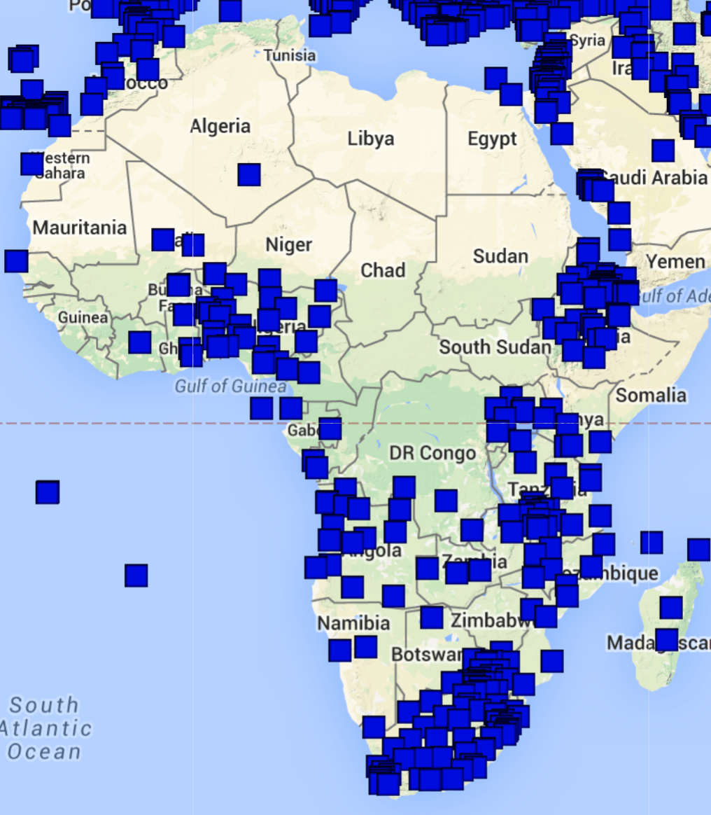
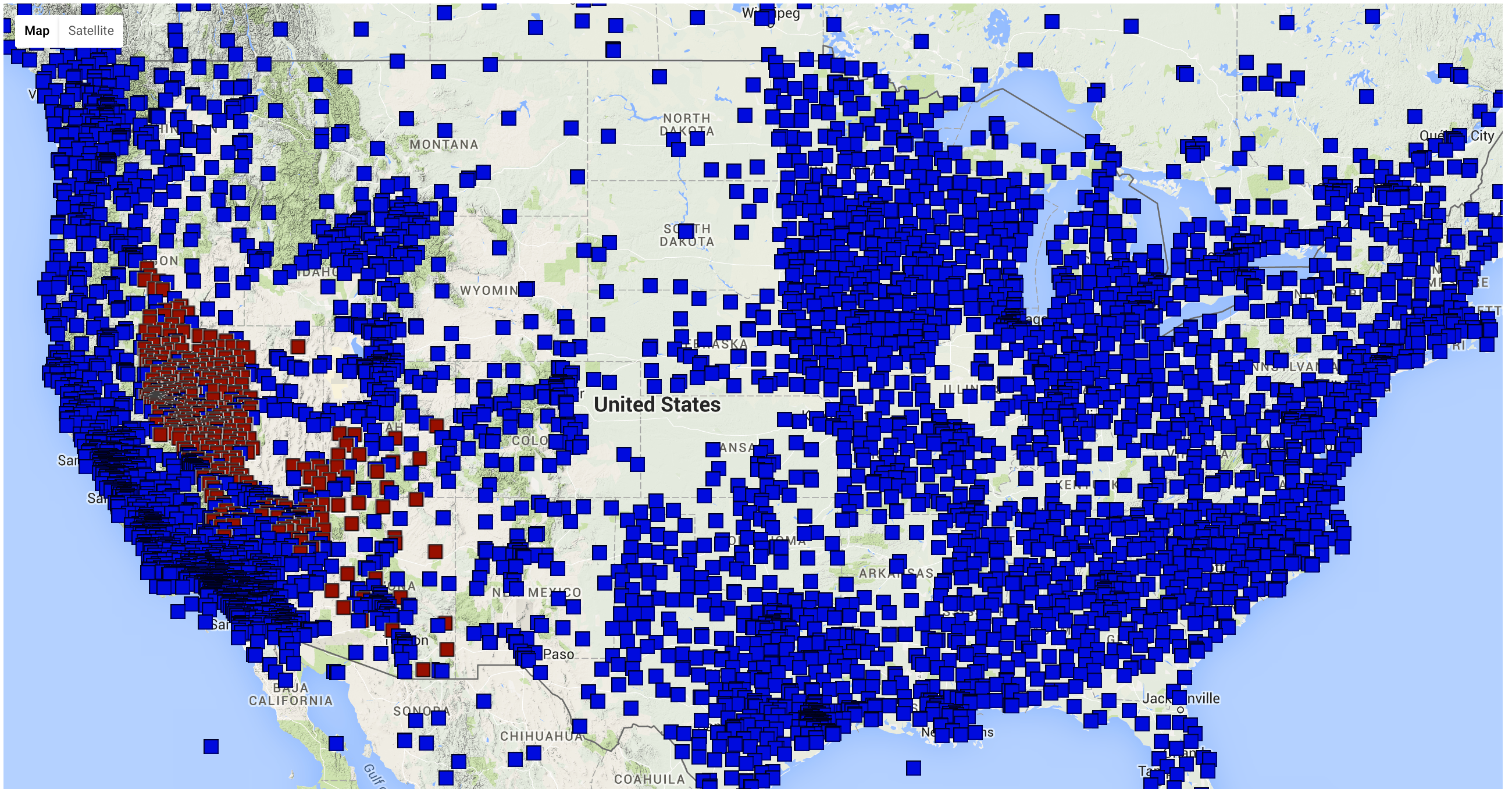
Graphical MAP BROWSE with links to station pages.
Find links to station pages and metadata using station name lists and/or text files:
- Stations with final solutions (24 hours sample rate, ~2 week latency): ( HTML / TXT )
- Stations with rapid solutions (24 hours sample rate, 24 hour latency): ( HTML / TXT )
- Stations with rapid solutions (5 minute sample rate, 24 hour latency): ( HTML / TXT )
- Stations with ultra rapid solutions (5 minute sample rate, ~2 hour latency): ( HTML / TXT )
- All time series are provided in a global (IGS08) reference frame and in a North America frame (NA12) for stations on the North American Plate.
Go directly to a station's page:
- http://geodesy.unr.edu/NGLStationPages/stations/<ssss>.sta
- where <ssss> is the station 4-character ID (use caps).
Search using lat/lon, time period, data type, format, etc.: UNAVCO GSAC
Find/Access stations and data using UNAVCO web services
Time series files direct access:
Here <ssss> is the station 4-character ID (use caps),
and <plate> is one of: AF, AN, AR, AU, BU, CA, CO, EU, IN, MA, NA, NB, NZ, OK, ON, PA, PM, PS, SA, SB, SC, SL, SO, SU, WL, which designates which plate the station is on or near.
- env format: http://geodesy.unr.edu/gps_timeseries/tenv3/IGS14/<ssss>.tenv3
- xyz format: http://geodesy.unr.edu/gps_timeseries/txyz/IGS14/<ssss>.txyz2
- File formats: README xyz and README env
or in a tectonic plate frame:
http://geodesy.unr.edu/gps_timeseries/tenv3/plates/<plate>/<ssss>.<plate>.tenv3
Time Series Plot Files:
- The best way to access plots of all available time series are by visiting the station pages.
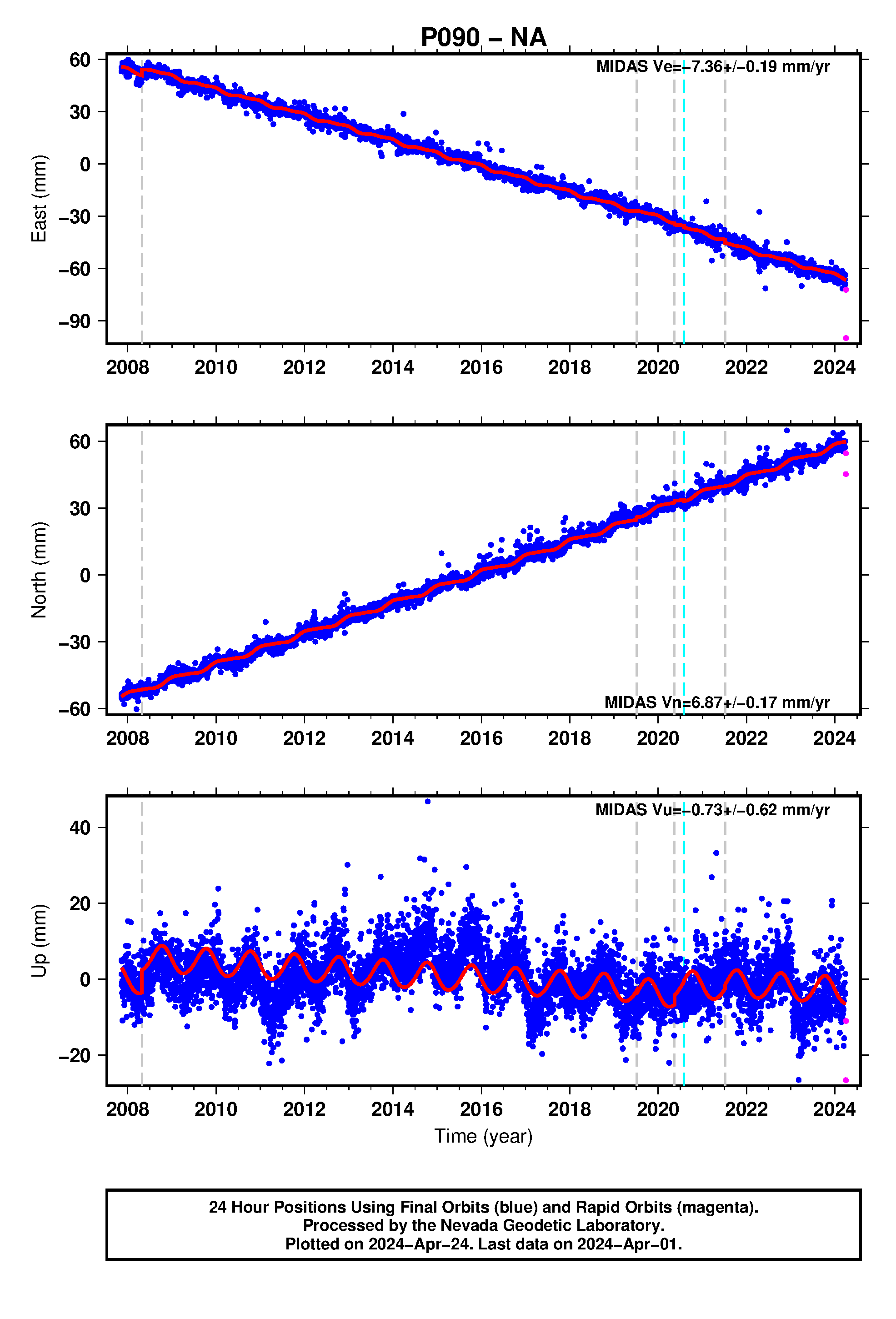
- Plots can also be accessed directly if the station 4 character ID and desired and the reference frame are known, e.g.:
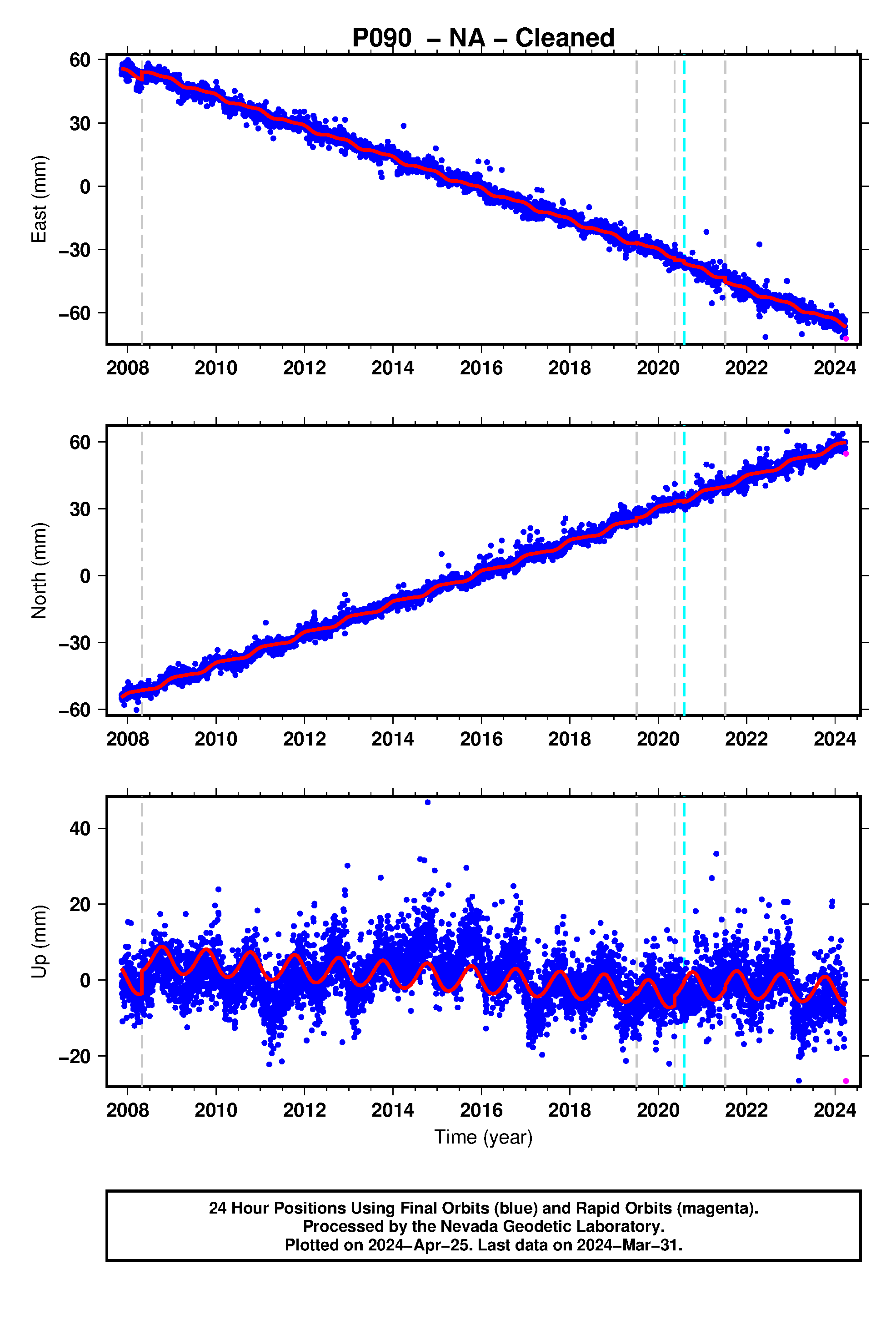
- For station P090 solutions in the NA reference frame are plotted at:
- "Cleaned" time series (outliers removed) are also available, e.g.:
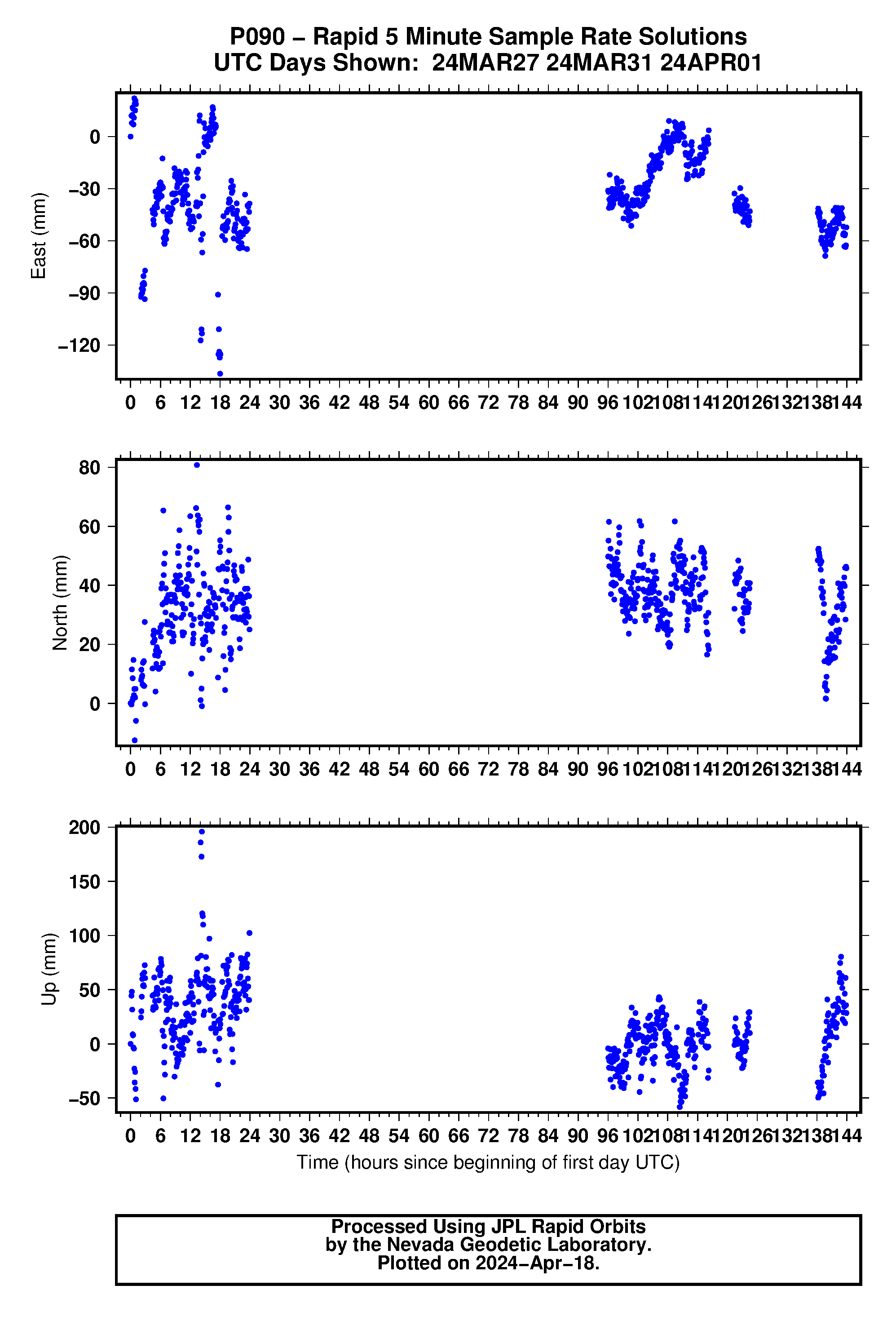
- For 5 minute rapid plots:
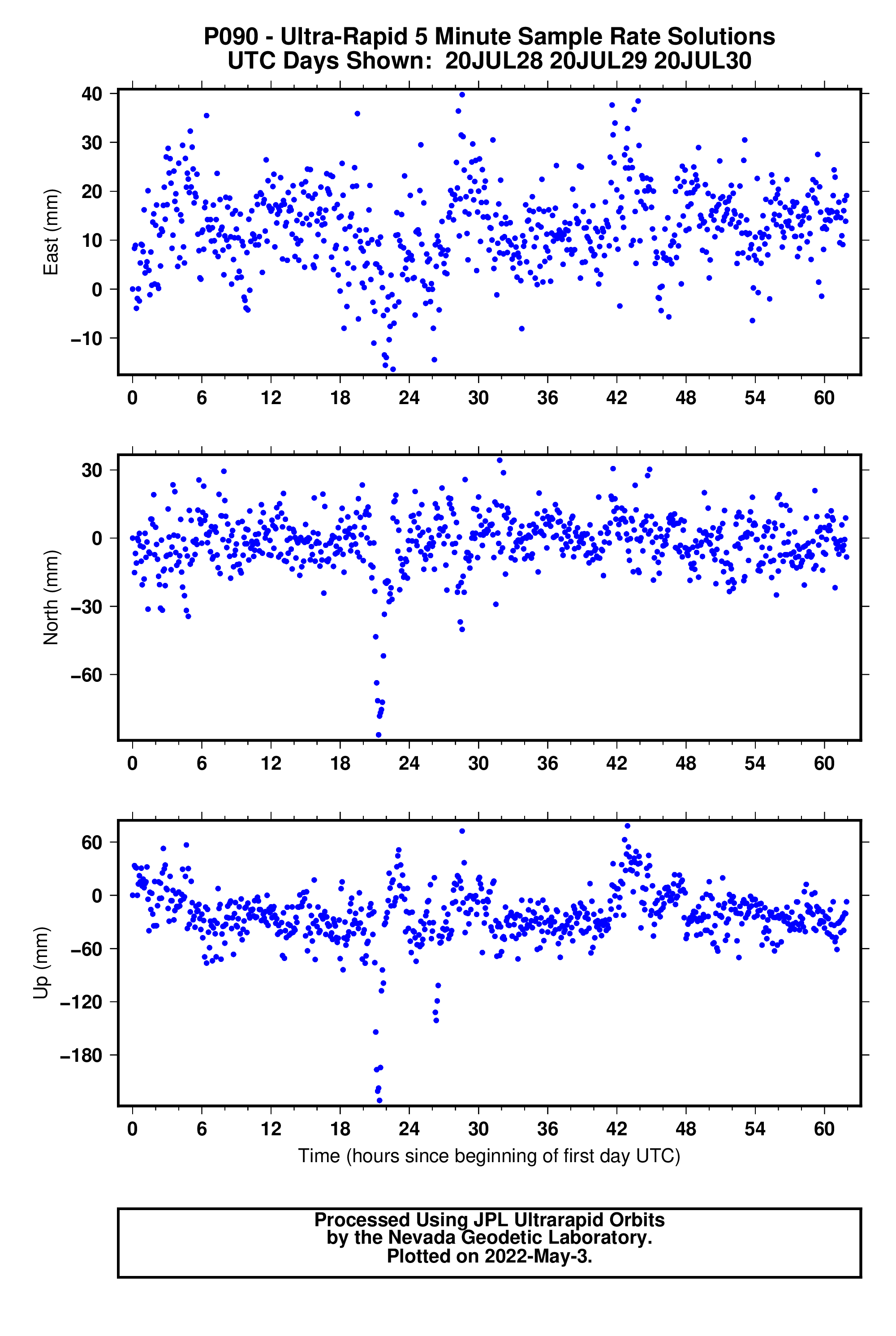
- And 5 minute ultra rapid plots:
Velocity Fields:
- MIDAS velocities are provided for all stations with over 1 year of data. Files are provided in all of the reference frames:
- NA
- IGS14
- README for MIDAS file data format
- Citation for these files available here (open access!) (Blewitt et al., 2016)
-
http://geodesy.unr.edu/velocities/midas.IGS14.txt
Steps Database:
- File includes known equipment change events and potential earthquake steps
Data Processing Quality Assurance Files:
-
Useful for assessing solution quality and debugging issues with processing
- Example: the .tar file of all QA files for site P090 is available at: http://geodesy.unr.edu/gps_timeseries/qa/P090.qa.gz
- Detailed Documentation of the QA files
Decimal Year Convention
- Translation file (text with DDMMMYY yyyy.yyyy)
- Explanation of the convention
Access Using Your Own Software and Workflow
- Most data products (e.g. time series, summary files, steps) are available as text files and are updated daily to weekly.
- In many cases files are machine readable, and can be obtained using wget/curl commands in scripts for incorporation into your local analyses.
Troposphere Products
- To make updating and transfer managable the troposphere files are packaged into yearly tar files.
- The format for the url is: http://geodesy.unr.edu/gps_timeseries/trop/<ssss>/<ssss>.<yyyy>.trop.zip
- An example link is for station QUIN's files for the year 2020: http://geodesy.unr.edu/gps_timeseries/trop/QUIN/QUIN.2020.trop.zip
- The Troposphere file format README file contains a brief explanation of these files.
- Link to IGS SINEX troposphere file format
GPS Data Processing Strategy
Acknowledgements
- Plug and Play GPS is funded by NASA under project NNX14AJ52A, Plug and Play GPS for Earth Scientists: Providing Immediate Access to Low-Latency Geodetic Products for Rapid Modeling and Analysis of Natural Hazards
- Also see our Acknowledgements Page
